


Tulsa Then & Now: Mapping the BFC app for iPhone and iPad
Developer: Tulsa City-County Library
First release : 30 Mar 2012
App size: 22.98 Mb
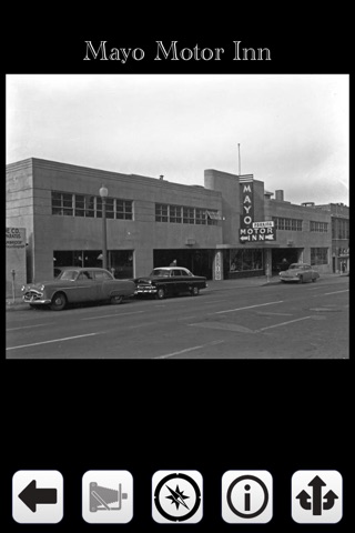
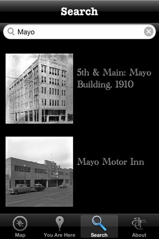
The Tulsa City-County Library’s "Tulsa Then and Now: Mapping the BFC" app provides access to approximately 300 photographs selected from the Beryl Ford Collection. It includes streets, buildings, and residences. Browse, search, and view these historic images that document growth and change in Tulsa. The photographs have been mapped to allow for location-based browsing and to enable you to find images nearby your current location.
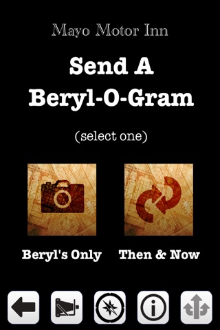
When you find a remarkable image from decades ago, share it via email, Twitter, or Facebook. Snap your own photo of present-day Tulsa and send it side-by-side with the historic image, creating your own custom Beryl-O-Gram. You can even use your iPhone’s camera to overlay the historic photograph with your current view.
Features:
· Access hundreds of historic images
· See a map with drop pins that represent the photos
· Search for a photo or location
· Browse photos taken nearby your current location
· Share images through email
· Share images on Twitter
· Share images on Facebook
Visit: http://www.tulsalibrary.org/tulsahistory/photographs.php to see more of the Beryl Ford Collection and to access other digital collections from the Tulsa City-County Library.
Preservation and archiving of the Beryl Ford Collection was made possible through the Tulsa City-County Library and the Tulsa Historical Society, and the generosity of Tulsa World/Lorton Family, Chester Cadieux, the Rotary Club of Tulsa, and many other community-minded corporations, institutions and individuals.